
Wednesday April 3, 2013
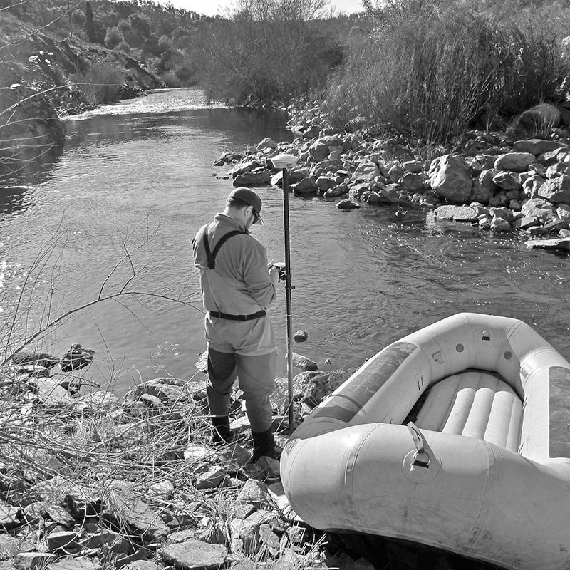
Drifting down the river in an inflatable raft sounds like a fine way to spend a spring day, but it can also be part of a scientific survey. Our biologists use these rafts to map the locations of redds, or salmon spawning sites (see It’s a wrap, Hunt for redds in October). Before they begin, they use a GPS to mark the starting point of the survey, as shown in this photo. Rather than taking in the scenery while floating along, the scientists spend their trip with eyes pointed downward, peering intently for patches of cleared gravel that spawning females have shifted to lay their eggs. Wearing polarized glasses makes it easier to see the riverbed through the water. After locating a redd, they record its GPS coordinates, measure its width and length, and note the water depth and velocity. These data help us understand the habitat and conditions that salmon choose for reproducing.