
Wednesday January 28, 2015
While much of the world relies on satellites for communication and entertainment in day-to-day life, satellites also serve many purposes for science. Satellites can be used for reconnaissance, space exploration, and remote sensing. Remote sensing refers to the ability to collect data on something without physically measuring it on the ground, such as using a satellite in space to measure sea surface temperatures on Earth. Tomorrow on January 29, the National Aeronautics and Space Administration (NASA) will launch a remote sensing satellite, known as the Soil Moisture Active Passive (SMAP) orbiting observatory, into space to measure and monitor drought conditions worldwide.
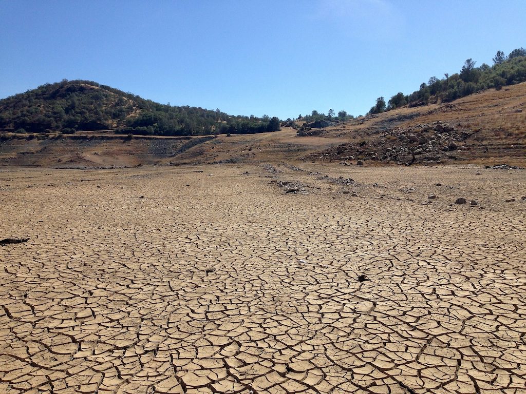
The SMAP orbiting observatory will allow for largescale and quick monitoring of moisture levels in the top two inches of soil across the globe. The conditions of this layer of topsoil are crucial for growing crops and other vegetation. The data collected by the satellite will help elucidate environmental patterns for predictive modeling and help assess potential regional impacts based on water availability. Moisture content data can be linked to several environmental factors in water, energy, and carbon flow models. The orbiting observatory will be able to collect data in areas that are otherwise inaccessible, and can determine whether land is frozen or thawed. Data will be collected every two to three days over a period of three or more years, and has many uses for natural resource management. It will allow scientists to create global soil moisture maps, track drought conditions, better predict changes in weather and climate, and forecast flood potential. The monitoring system will also serve as an early warning mechanism for agricultural water stress (The Jet Propulsion Laboratory 2014).
With drought conditions plaguing California and many other parts of the United States, it is especially important to monitor water availability and be conscientious of water allocation. Throughout California, many people have responsibly cut back on wasteful water usage, converted to xeriscaped yards, and participated in other water conservation activities. The SMAP orbiting observatory is the latest high-tech tool that will help work toward a more water-secure future. It will likely be a while before data from the SMAP orbiting observatory are available; however, in the meantime, you can track drought conditions here in the United States at the United States Drought Monitor website.