Aerial mapping using drone imaging technology is a fast and cost-effective method to survey, document, categorize and measure large reaches of rivers or creeks. Our drone pilots hold Part 107 UAS certifications from the Federal Aviation Administration and have used drone photography and videography to map floodplain habitats, collect topography data for potential river restoration sites, and survey salmon and trout redds in hard-to-access locations.
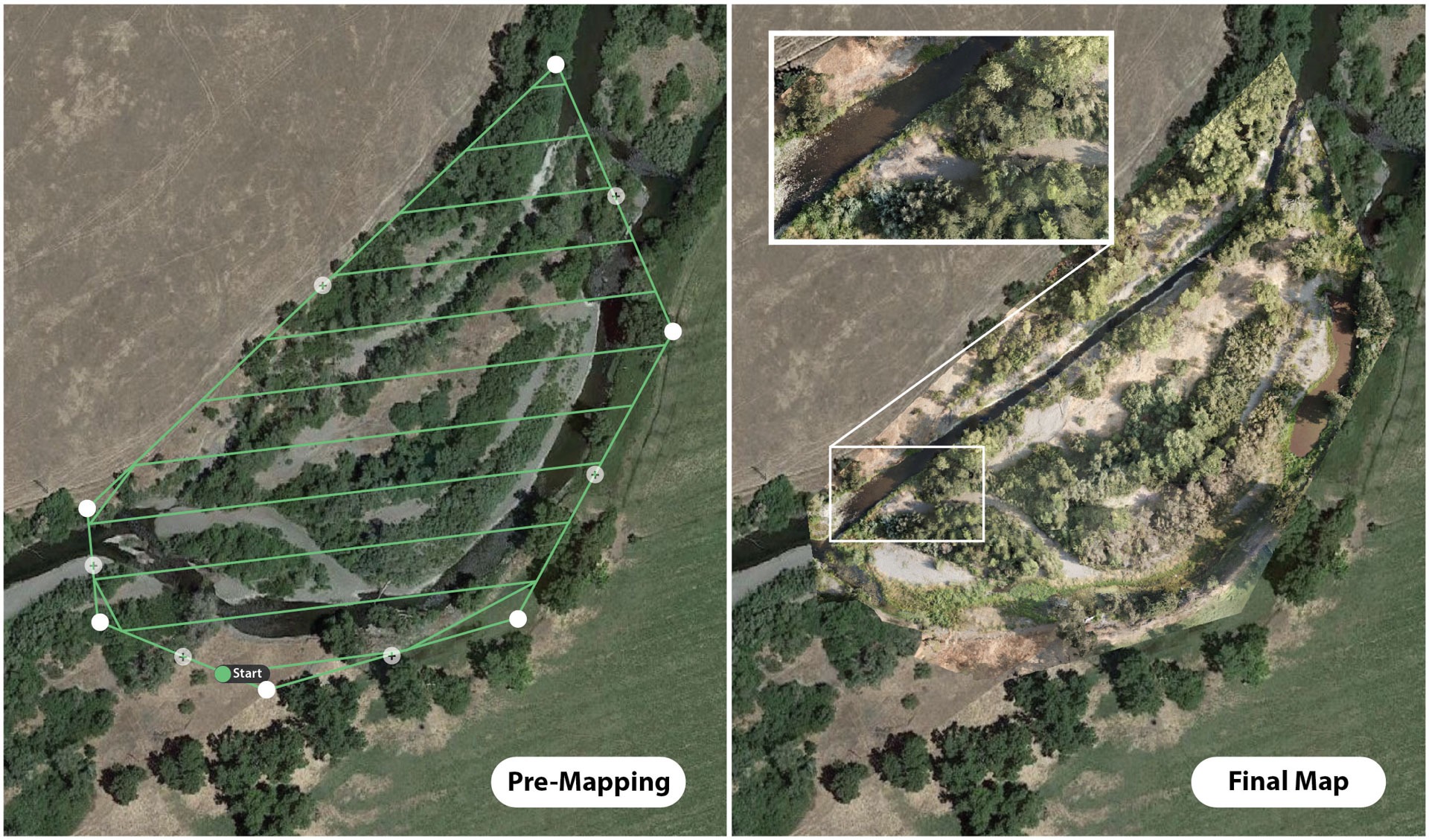
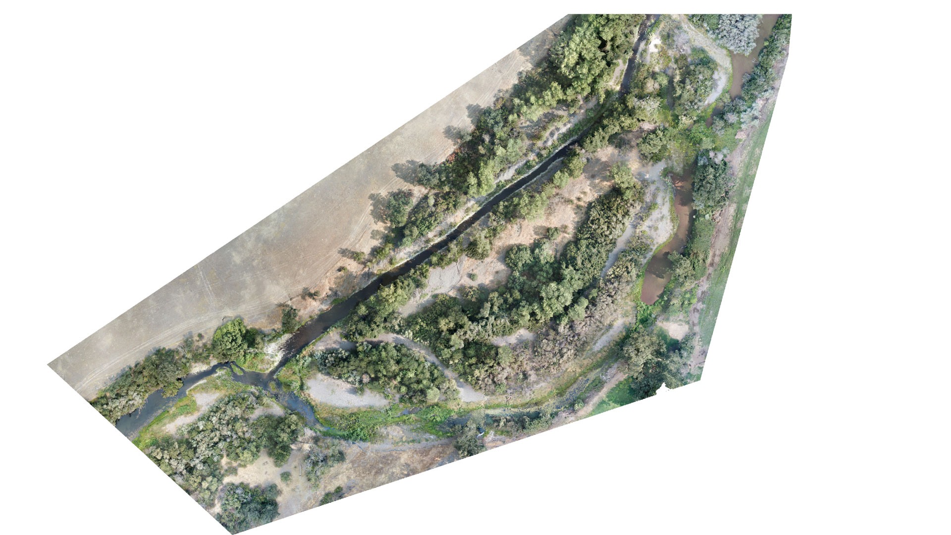
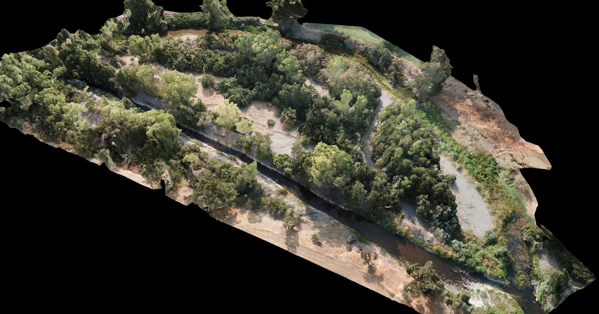
We are experienced in pre-mapping procedures, which includes determining flying grid patterns at calibrated elevation to capture overlapping imagery. Captured drone imagery is then used to create high-resolution, georeferenced orthomosaic aerial or 3D maps that can be used with professional GIS software. These maps, in turn, can be used to identify, measure and quantify habitat features and physical characteristics of interest, such as the presence of woody debris, or the area and elevation of particular habitat types. On-site drone operation is frequently accompanied by supplementary data collection, such as water quality parameters, to permit a comprehensive evaluation of habitat characteristics across a broad geographic scale.
FISHBIO has used georeferenced maps with GIS and AutoCAD software to produce real-size drafts of custom-built monitoring systems for various clients. Contact us to discuss how we can help map your project area.